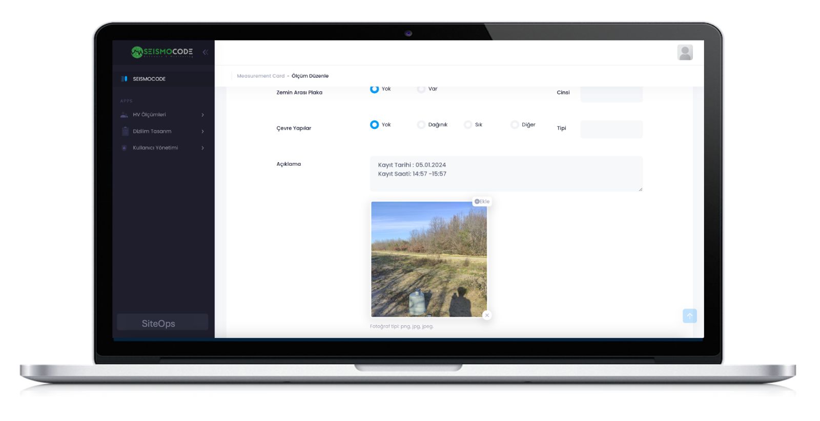
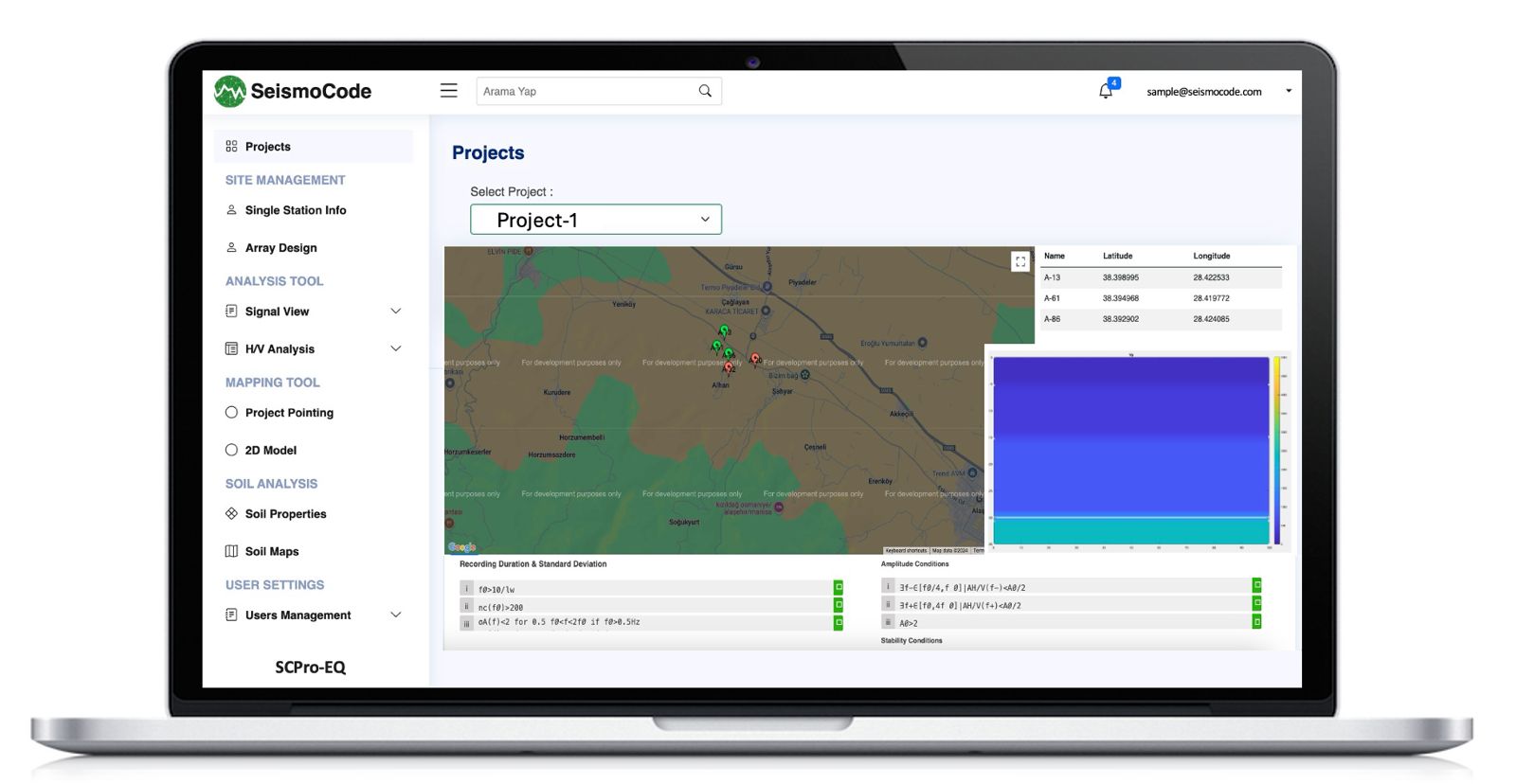
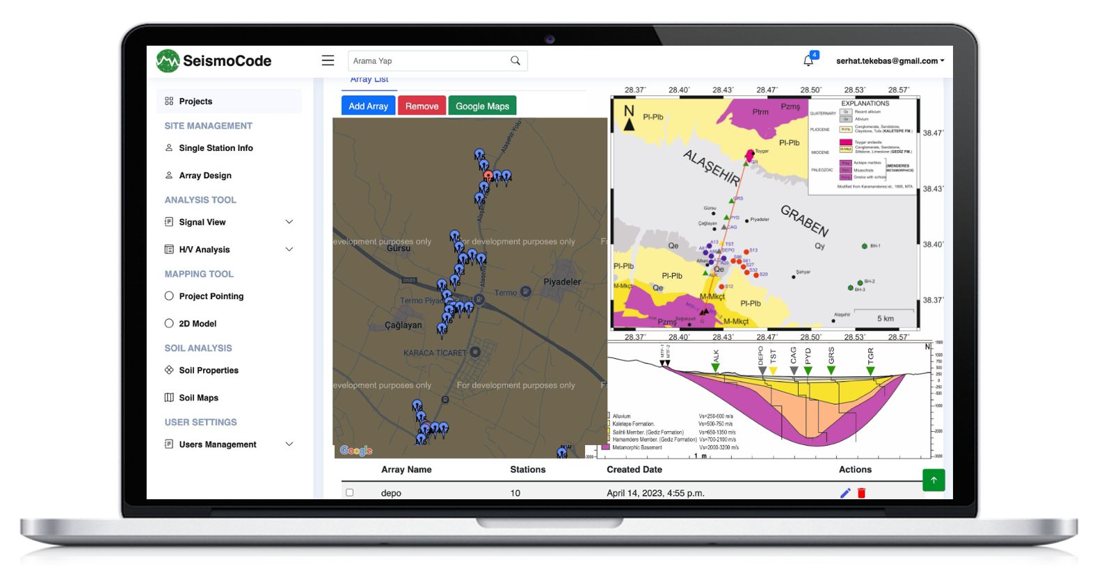
Hear the Earth
We are developing software that helps you manage field operations and enhance the interpretation of geological and geophysical data, leading to the creation of sectional views and maps for a better understanding of underground structures.

Field Management
With Field Management, effortlessly coordinate and oversee multiple projects, each with unique operators, ensuring streamlined operations and efficiency in the field. Safely label and archive your data in the cloud, guaranteeing secure access and organization anytime, anywhere.

Analysis
Explore the depths of geophysical data with our Analysis Tool, expertly designed for in-depth time-domain studies like spectrum and microtremor analysis. Uncover crucial insights and patterns, transforming raw data into valuable, actionable information.”

Map & Section
With Map & Section, effortlessly create detailed contour maps and 2D cross-sections by selecting and marking analyzed data directly on the map. Transform 1D depth velocity graphs into comprehensive 2D sections with ease, by combining points chosen by users on the map.

Measurement Card
Utilize the Measurement Card tool to comprehensively document every aspect of a measurement point, from coordinates, date, and operator details to location, weather conditions, and soil type. Seamlessly integrate raw data and images, ensuring a detailed and organized record for each data collection effort.
Mapping
Empower your field setup management and organization with our intuitive Mapping tool: simply select any point on the map to instantly access detailed views of the underground structure. Streamline your project workflow with precision and ease, revolutionizing how you visualize and plan your geophysical explorations.


Cross-Section
Effortlessly generate detailed cross-sections with our Cross-Section tool, tailored to transform selected points into vivid, dimensional representations. This feature provides an essential visual aid, deepening your understanding of the subsurface layout and composition.